After Ushuaia, our itinerary took us back to Buenos Aires for a day. In BsAs we made one last stop at our favorite empanada place – Pini Empandas. From there we bid farewell to South America. We had so many wonderful experiences, and leave knowing that we’ve only scratched the surface of a continent that’s nearly twice the size of the US.
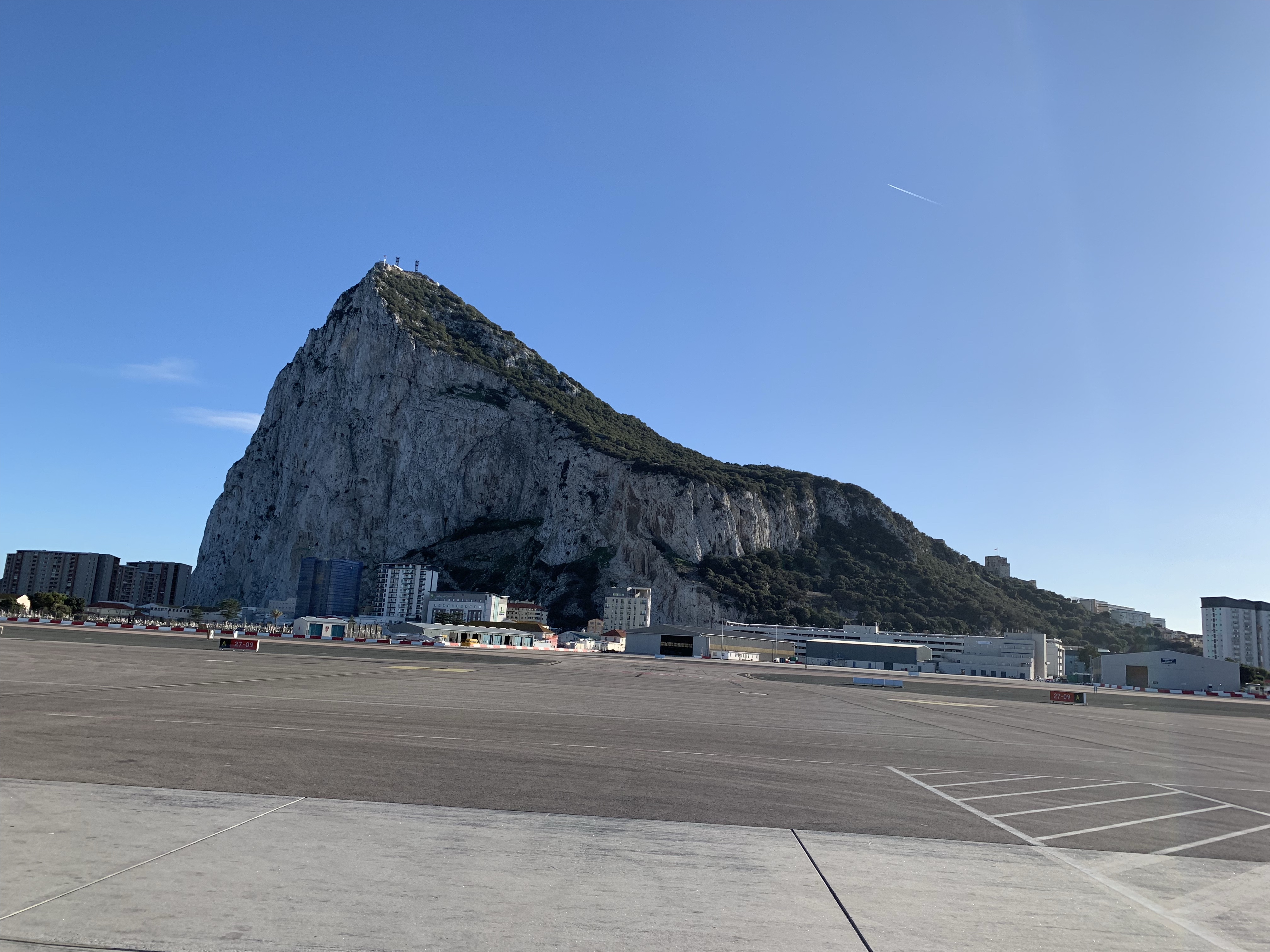
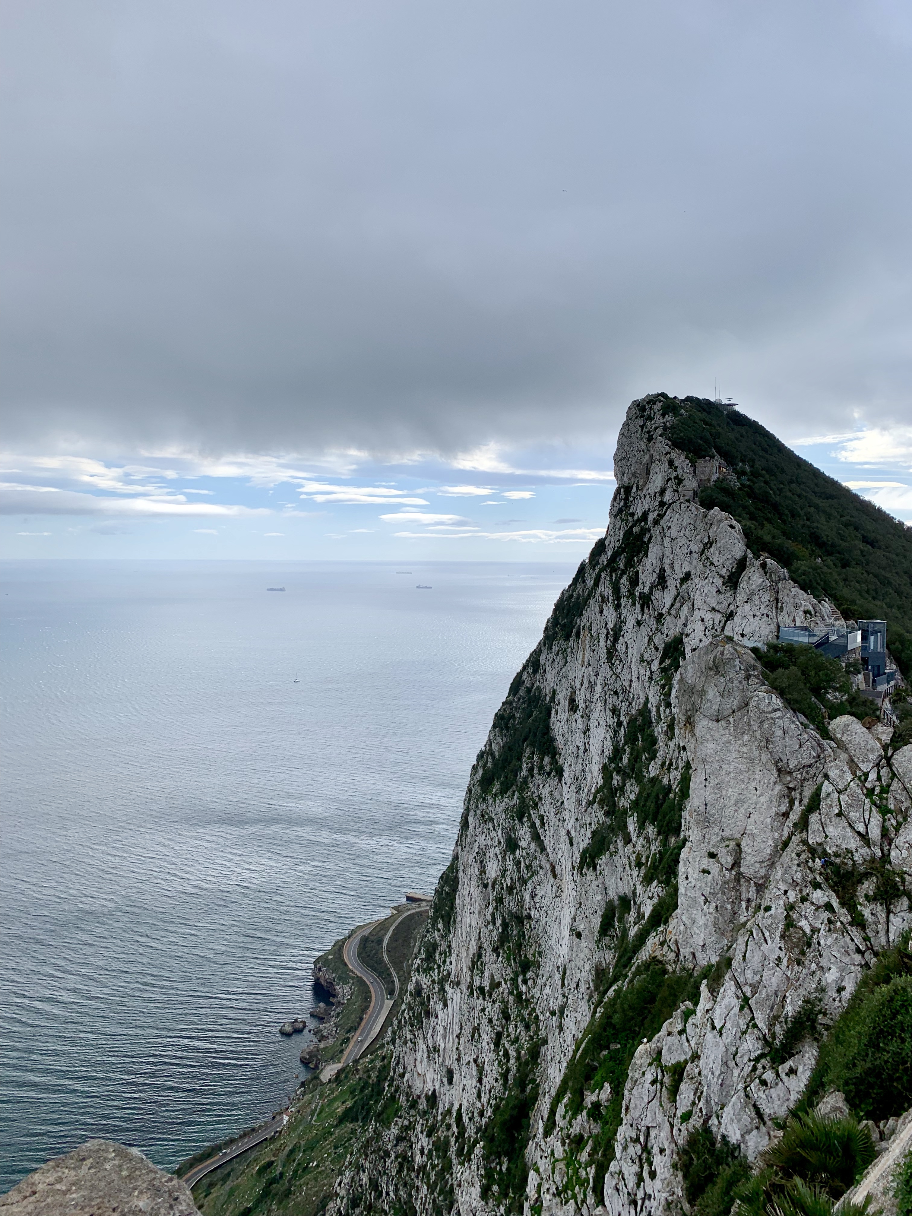
From Buenos Aires we flew nearly 13 hours to London*, then got on a plane bound for Gibraltar. Gibraltar is a British territory situated on the end of a peninsula near the southern tip of Spain. It’s tiny: only 2.6 square miles, most of which are taken up by a giant limestone mountain known as “The Rock.” The Rock is one of the two Pillars of Hercules of Greek mythology, marking the western edge of the Mediterranean Sea (and the end of the world, as far as most Mediterranean mariners were concerned).
We chose to visit Gibraltar because it’s near our next destinations, the boys are fascinated by the airport, and I’m fascinated by its role in history.
First, the airport.
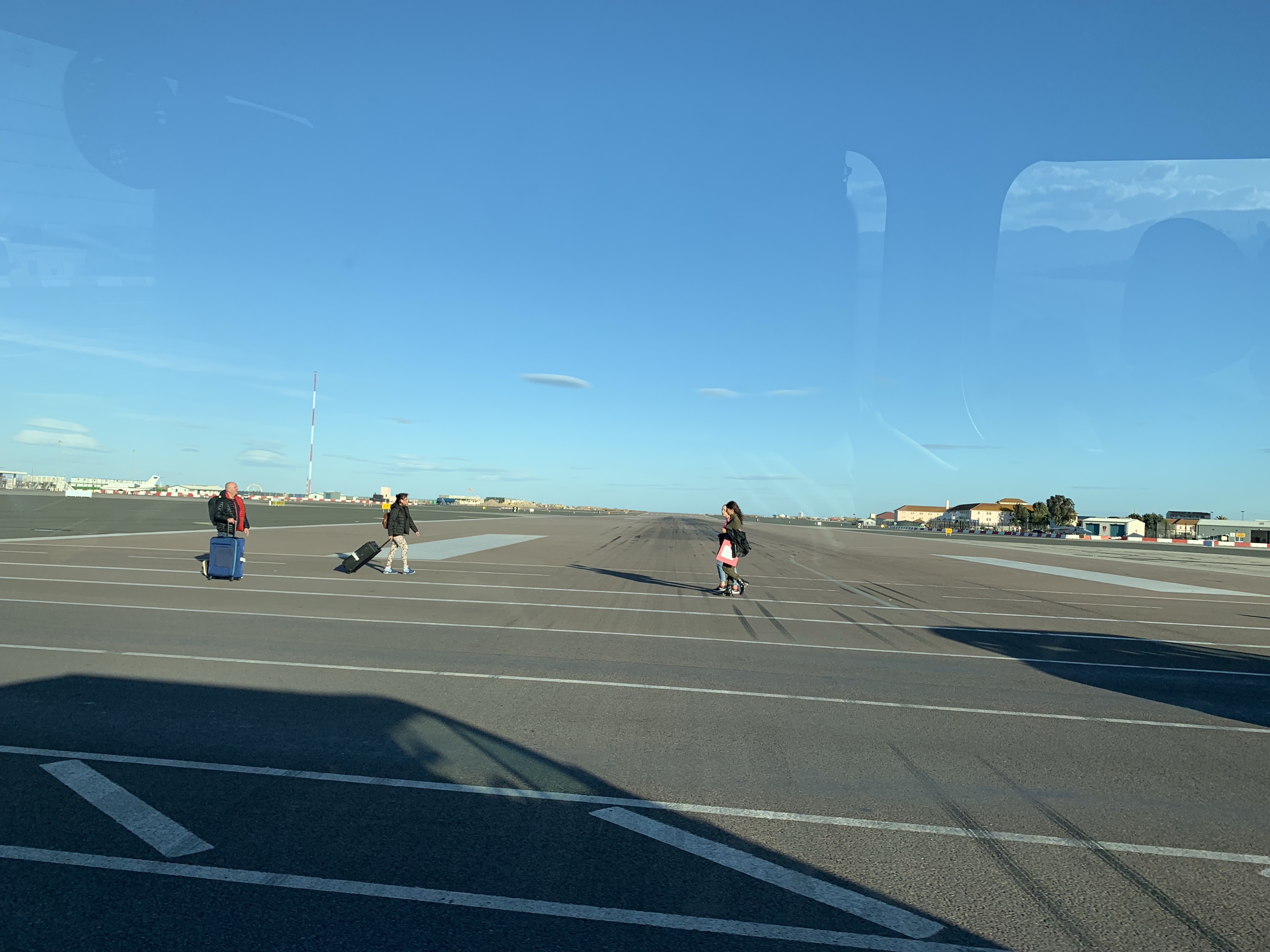
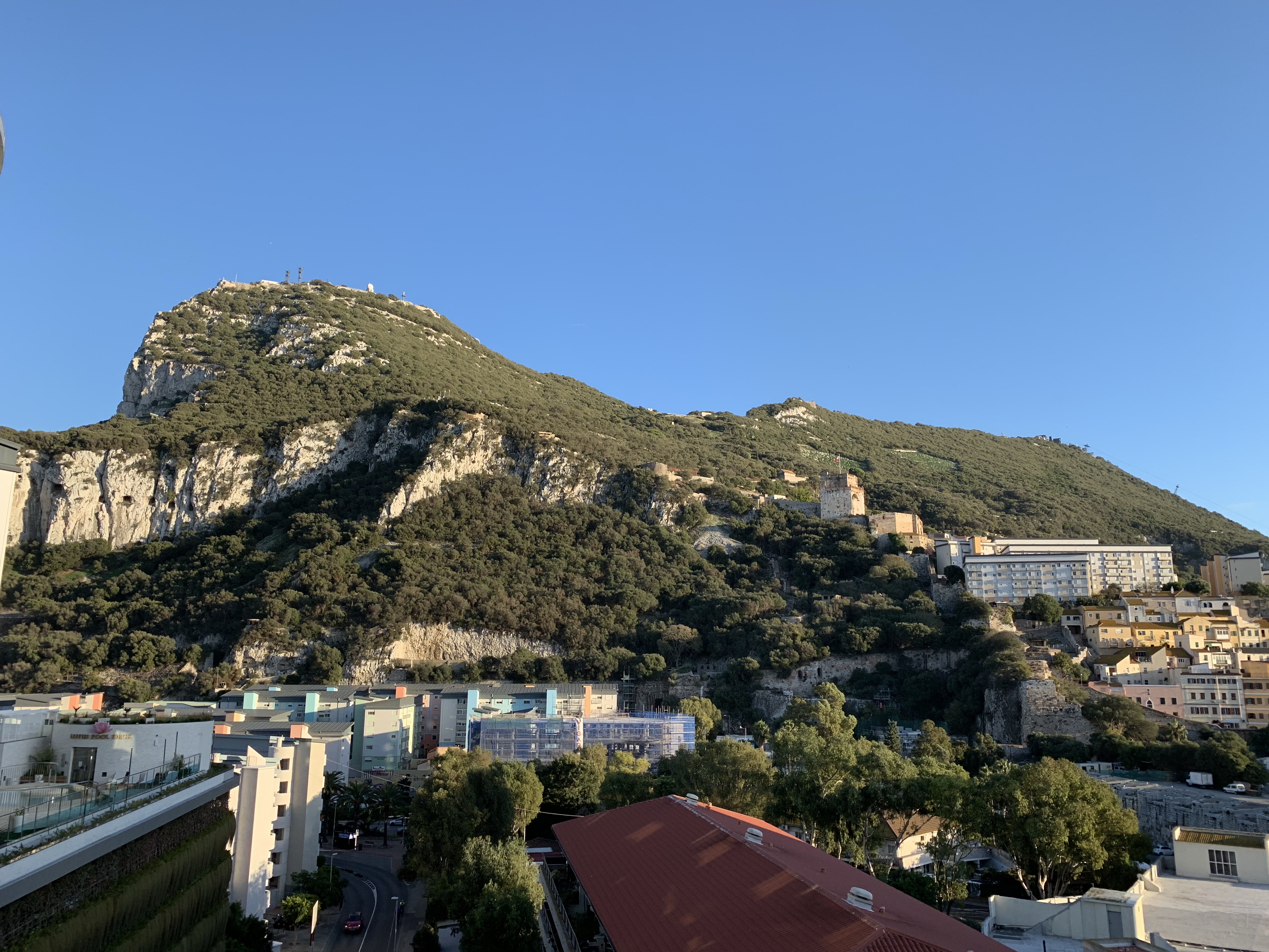
There wasn’t enough room in Gibraltar for an airport, so during World War II the British built one from landfill. The result is a single runway that bisects the isthmus connecting the Rock to the rest of the Iberian peninsula. The airport is right up against the Spanish border, and the main road from Spain to the rest of Gibraltar crosses the runway. Each time a plane takes off or lands, the road has to be closed and the runway/roadway checked for debris. The airport is also known as being very dangerous due to the swirling winds and fog created by the Rock. Luckily we didn’t have any trouble landing, and the boys got to cross the runway in a taxi.
The history of Gibraltar is fascinating, and too long for a blog post. I recommend Ernle Bradford’s Gibraltar: The History of a Fortress, which covers both the history of Gibraltar and the geography that shaped that history.
Gibraltar’s location made it an important base for the British military for nearly 250 years. Gibraltar effectively controls access to the Mediterranean sea from the Atlantic, which allowed the British to exert control over the Mediterranean. It also served as a supply depot and friendly port for the British navy during the numerous wars of the 18th and 19th centuries, such as the Napoleonic wars. I’ve read a great deal of historical fiction and non-fiction about the British navy’s exploits during the 1700s and 1800s, so it was exciting to see in person such an important port.
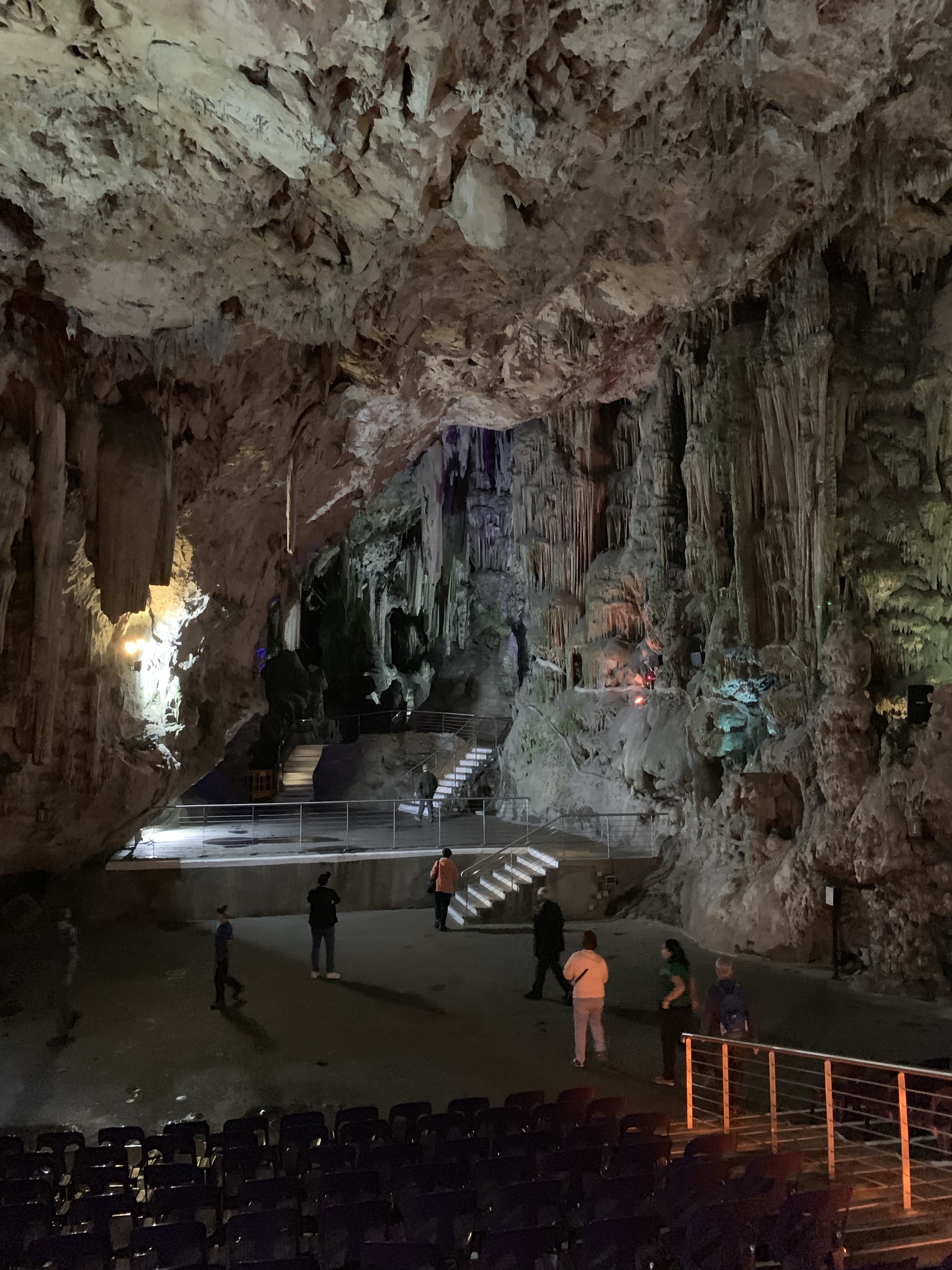
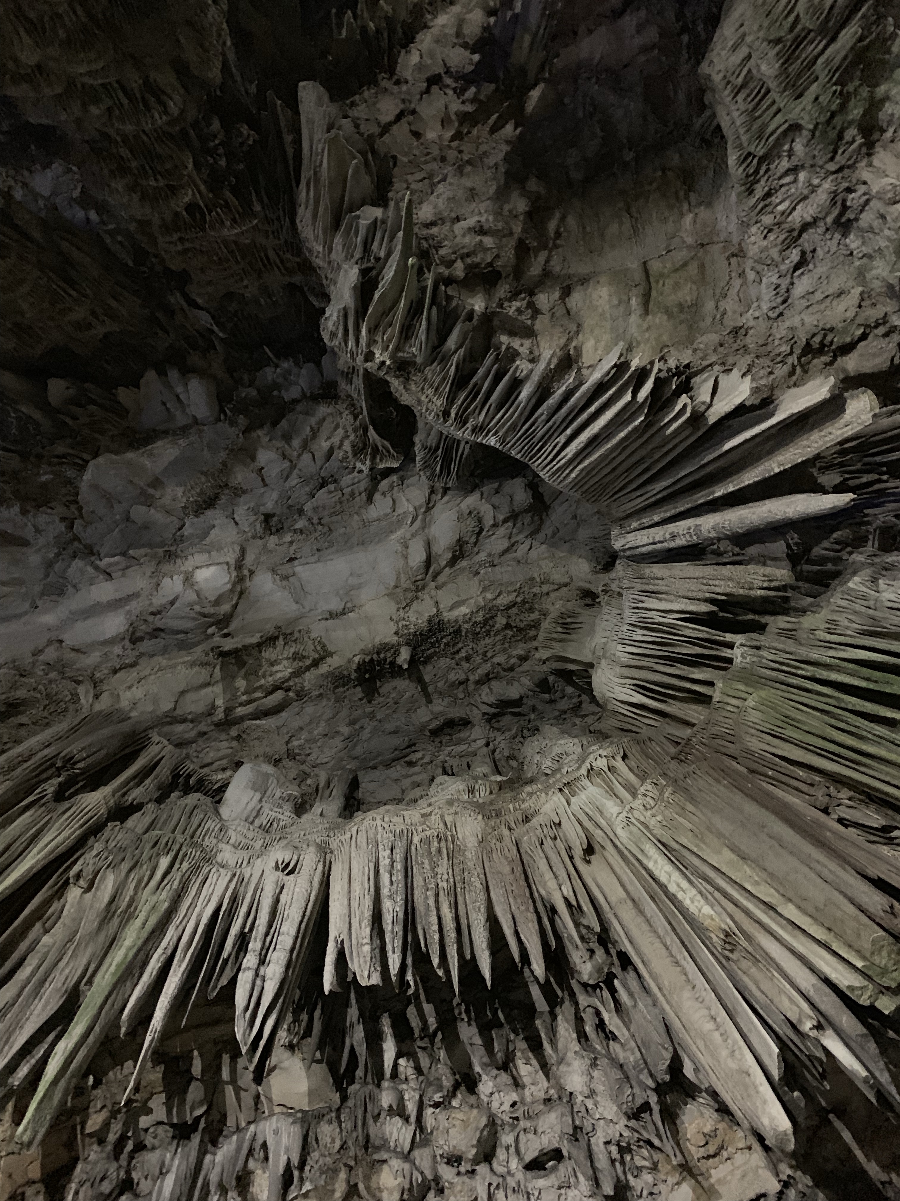
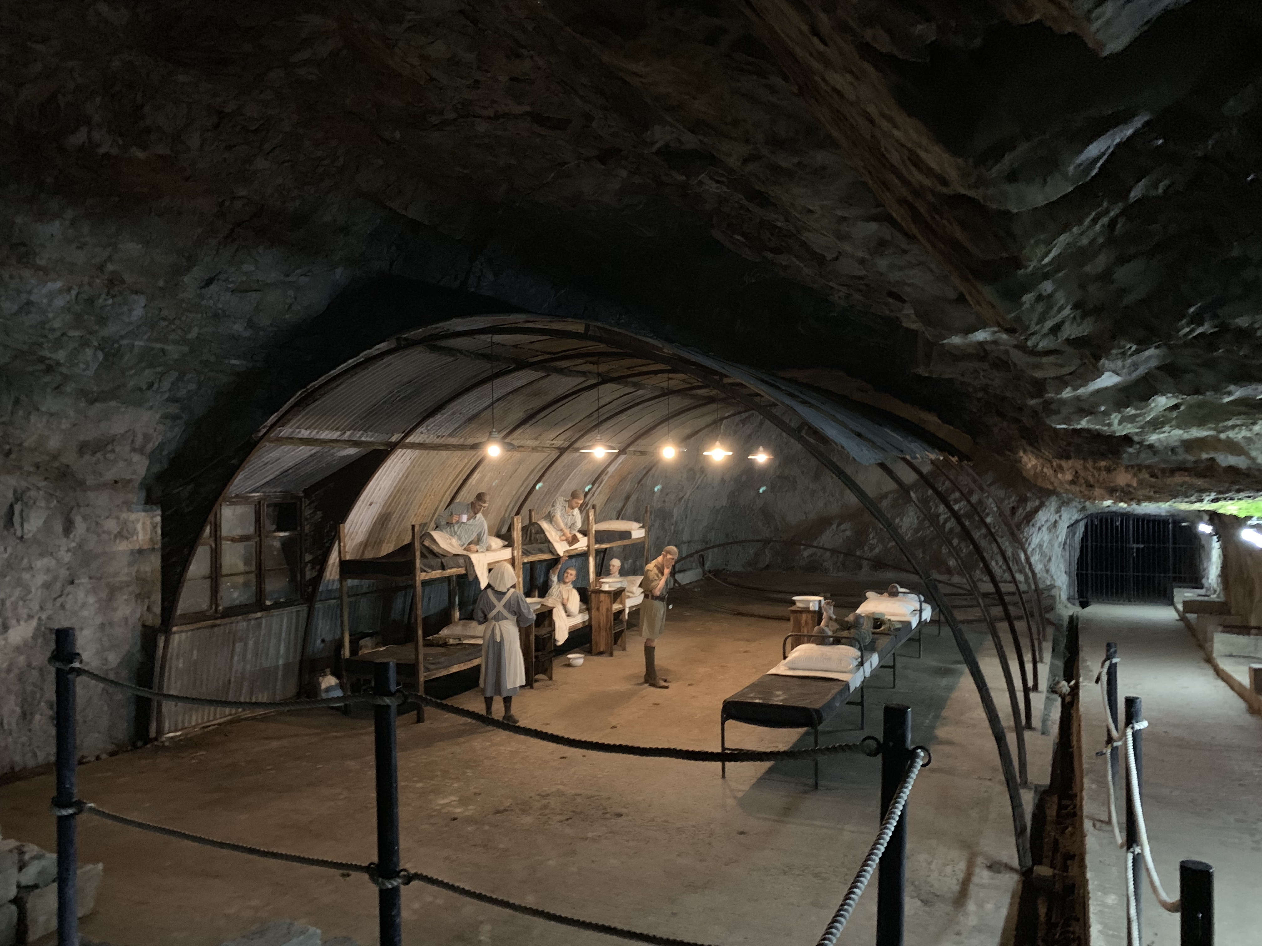
We hired a taxi to give us the “official tour” of the Rock. This included a visit to St. Michael’s Cave – once thought to be bottomless and the entrance to Hades. During WWII the cave was prepared for use as a hospital (turns out it was not needed), and today it serves as an auditorium.
After the cave we drove up to the top of the spine of the Rock, where we met some of the local population of Barbary macaques. These monkeys – the only wild monkeys in Europe – are quite comfortable around humans, and have a propensity for stealing food, bags, and so on. Each one has a different personality, and the drivers know some of them by name. “Slappy” likes to give high-fives to passersby.

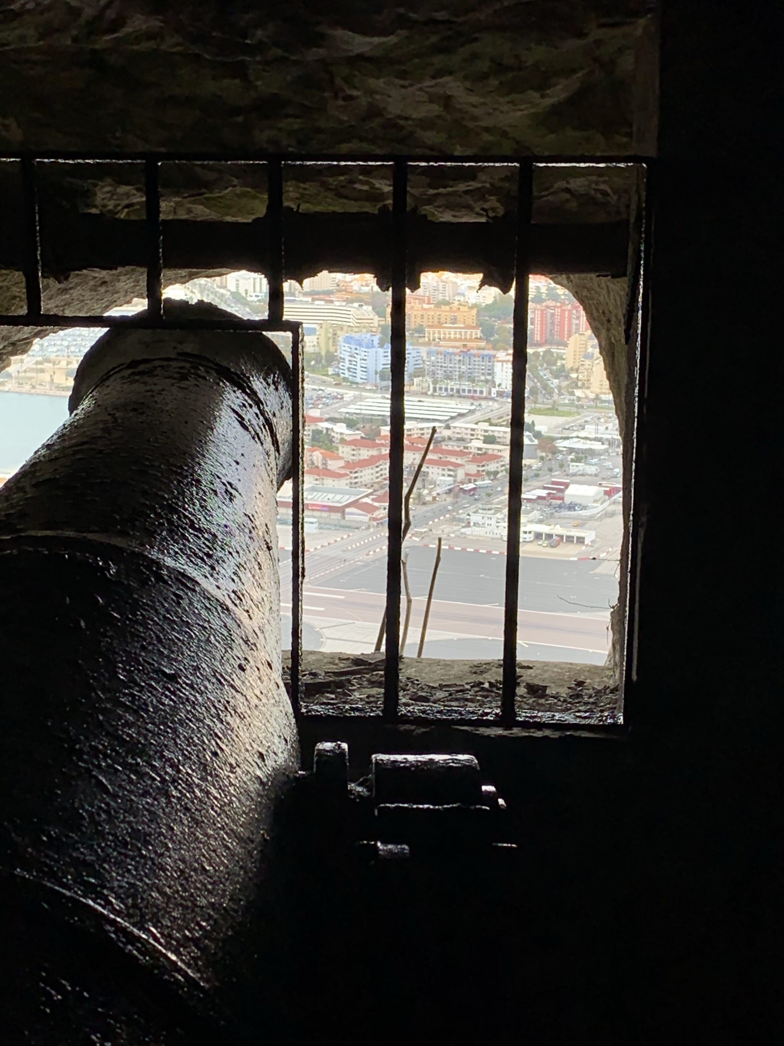
Next we visited the “Siege tunnels”, so-called because they were built during the 3+ year “Great Siege” of the late 1700s. These tunnels were designed to hold huge guns for defending against armies attacking from the mainland.
Due to its military significance, Gibraltar has been attacked a great deal. To defend against attack, the British built a web of tunnels inside the Rock containing guns, supplies, barracks, hospitals, and more – an entire city. This network was expanded in World War II, and today the length of the tunnels inside the Rock exceeds the length of roadway in the rest of the territory! While the threat of a Spanish invasion is low, Spain and the UK are still at odds over the territory. How would Americans feel if Cape Cod belonged to a foreign power?

After visiting the Siege Tunnels we toured the World War II tunnels. Up to 16,000 people lived inside these tunnels during the war! We exited the tunnels to find that it was pouring, and despite our rain gear we were instantly soaked by the wind-driven rain. Luckily the weather let up, and by the time we had walked back to town it was sunny and we were drying off.
We only had one full day in Gibraltar, but that was enough to see most of what we wanted to. Other attractions on the Rock include tax-free shopping, a cable car that is widely dismissed as overrated and not worth the long lines, and a variety of fortifications left over from hundreds of years of military occupation and conflict. I would have enjoyed another couple of days to explore, but it was time to catch a ferry across the Straits to our next destination: Morocco!
* For all you navigators / cartographers / geography nerds, Ushuaia to London is a change of more than 105 degrees latitude!

3 replies on “The Rock: Gibraltar”
[…] international airport from downtown. Upon landing in London, we had 6 hours before our flight to Gibraltar (2 1/2 hours long) where had to switch terminals (requires 2 trains) and collect and recheck our […]
LikeLike
Wow! So much history… I had no idea. Fitting a city inside the rock …incredible.
LikeLike
What a great experience! Hope the Next Gen appreciates this!
LikeLike